Category:Geography of Tenerife
Jump to navigation
Jump to search
Islands of the Canary Islands: Fuerteventura · La Gomera · Gran Canaria · El Hierro · Lanzarote · La Palma · Tenerife
Wikimedia category | |||||
| Upload media | |||||
| Instance of | |||||
|---|---|---|---|---|---|
| Category combines topics | |||||
| geography | |||||
science that studies the terrestrial surface, the societies that inhabit it and the territories, landscapes, places or regions that form it when interacting with each other | |||||
| Pronunciation audio | |||||
| Instance of |
| ||||
| Different from | |||||
| Partially coincident with | |||||
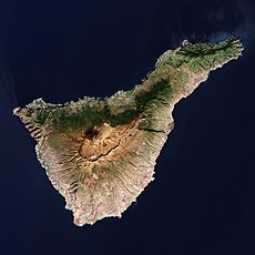
| Tenerife | |||||
largest island of the Canary Islands | |||||
| Instance of |
| ||||
| Part of | |||||
| Location | Atlantic Ocean, international waters | ||||
| Located in or next to body of water | |||||
| Highest point |
| ||||
| Population |
| ||||
| Area |
| ||||
| Elevation above sea level |
| ||||
| official website | |||||
 | |||||
Subcategories
This category has the following 13 subcategories, out of 13 total.
*
B
C
F
L
P
S
Media in category "Geography of Tenerife"
The following 44 files are in this category, out of 44 total.
-
Aguaide.JPG 640 × 480; 162 KB
-
Anaga Massif and Teide volcano on Tenerife.jpg 4,272 × 2,848; 8.75 MB
-
Atardecer en Anaga.JPG 3,648 × 2,736; 1.56 MB
-
Barranco del Somedo. - panoramio.jpg 4,864 × 2,736; 6.57 MB
-
Barranco Hondo desde el cruce.JPG 640 × 480; 133 KB
-
Barranco Hondo.JPG 640 × 480; 127 KB
-
Barrio de La Alegría.JPG 533 × 400; 43 KB
-
Casas en Batán de Arriba.JPG 3,648 × 2,736; 1.52 MB
-
Casas Heleras y casas del Batán de Abajo..JPG 3,648 × 2,736; 1.52 MB
-
CUEVA BLANCA - panoramio.jpg 2,816 × 1,872; 2.36 MB
-
El Palmeral junto a La Gran Casona en La Rambla de Castro.jpg 3,648 × 2,736; 1.7 MB
-
El Roque Milano, visto desde la carretera del Batán.JPG 3,648 × 2,736; 1.62 MB
-
Fortín de San Fernando, en la Rambla de Castro.jpg 3,648 × 2,736; 1.51 MB
-
Interián acantilado de gran valor paisajístico.jpg 3,648 × 2,736; 1.51 MB
-
Interián Sitio de interés científico.jpg 3,648 × 2,736; 1.5 MB
-
Interián un abrupto acantilado.jpg 3,648 × 2,736; 1.52 MB
-
Interián.jpg 3,648 × 2,736; 1.5 MB
-
La Ensillada, detrás de la roca de La Jurada-El Pijaral.JPG 3,648 × 2,736; 1.46 MB
-
La Gran Casona en La Rambla de Castro.jpg 3,648 × 2,736; 1.69 MB
-
LaEsperanzaTenerife.jpg 756 × 743; 450 KB
-
Las Casas Heleras, en el Batán.JPG 3,648 × 2,736; 1.52 MB
-
Las Palmas de Anaga.JPG 2,934 × 1,732; 3.52 MB
-
Lomo de las Bodegas y Cumbrilla.jpg 1,024 × 523; 335 KB
-
Los Roques de Anaga, vistos desde el Roque de las Ánimas.JPG 3,648 × 2,736; 1.66 MB
-
Mirador de Aguaide.jpg 1,600 × 1,065; 292 KB
-
Otro lateral de La Gran Casona de La Rambla de Castro.jpg 3,648 × 2,736; 1.51 MB
-
Paisaje de La Rambla de Castro con su Casona. Los Realejos.JPG 3,648 × 2,736; 1.64 MB
-
Panorámica de Los Batanes.JPG 3,648 × 2,736; 1.57 MB
-
Poste del sendero en una intercesión del sendero PR TF-12.JPG 2,048 × 1,536; 1.38 MB
-
Roque dos Hermanos y al fondo la Punta de Hidalgo.JPG 640 × 480; 160 KB
-
Sendero La Ensillada- Mirador Cabeza del Tejo.JPG 3,648 × 2,736; 1.52 MB
-
TanDEM-X 3D model of Mount Teide on Tenerife Island (PNG).png 2,336 × 1,344; 5.34 MB
-
TanDEM-X 3D model of Mount Teide on Tenerife Island (TIFF).tif 2,336 × 1,344; 7.46 MB
-
Tenerife 1977 02.jpg 1,060 × 581; 238 KB
-
Tenerife 1977 03.jpg 701 × 1,060; 243 KB
-
Tenerife 1977 11.jpg 1,060 × 705; 273 KB
-
Tenerife 1977 12.jpg 1,060 × 705; 320 KB
-
Tenerife 1977 28.jpg 5,274 × 2,074; 8.44 MB
-
Teneriffa - panoramio (3).jpg 5,184 × 3,456; 5.33 MB
-
Un balcón hacia el Atlantico.JPG 3,648 × 2,736; 1.48 MB
-
Un lateral de La Gran Casona de La Rambla de Castro.jpg 3,648 × 2,736; 1.52 MB
-
Valle Brosque I.jpg 512 × 384; 32 KB
-
Way to the volcano - panoramio.jpg 5,184 × 3,456; 3.64 MB
-
Collage San Cristóbal de La Laguna.jpg 404 × 404; 98 KB


.png/120px-TanDEM-X_3D_model_of_Mount_Teide_on_Tenerife_Island_(PNG).png)
.tif/lossless-page1-120px-TanDEM-X_3D_model_of_Mount_Teide_on_Tenerife_Island_(TIFF).tif.png)


.jpg/120px-Teneriffa_-_panoramio_(3).jpg)


